


"Hydromorphology", as defined by the WFD, is the physical characteristics of the shape, boundaries and content of a water body.
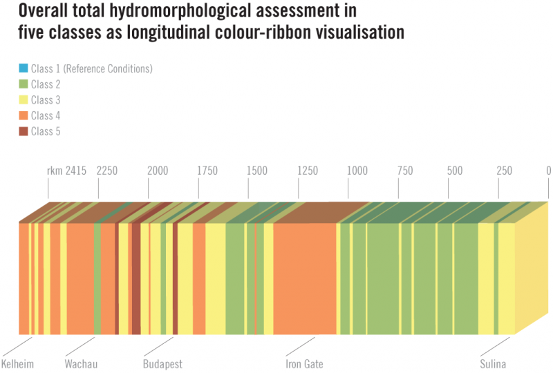
The assessment of the hydromorphology of the Danube was a completely new task for the JDS2, needed to better assess how the basin can meet the WFD requirements for "good ecological status". Since the 16th century, people have been changing the natural course of the rivers in the Danube Basin, mainly for hydropower generation, flood defence and navigation. Many changes affected the ecological quality of the rivers and reduced their naturalness.
The JDS2 found that about 40% of the investigated Danube indicated a satisfactory condition, meaning that there are still many areas with generally healthy ecological conditions - a status that is generally more positive than earlier perceived. The situation in the Lower Danube is better than in the Upper part. However, another third of the Danube is strongly altered by human actions with many areas requiring attention.
Overall, the relatively positive status found for Danube hydromorphology indicates a good basis for protecting that status into the future as well as for providing the basis for additional restoration activities.

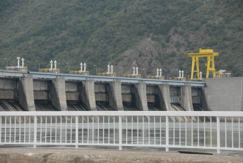
The Upper Reach in Germany and Austria is the most affected by hydromorphological changes. Only very few areas still host free-flowing and near-natural conditions. Totally modified, canalised stretches can be found, and most of the chain of hydropower plants in Germany and Austria are severely or totally modified.
On the other hand, the Middle and Lower courses of the Danube are interrupted only by three large hydropower plants. Good conditions can be still found at the Danube Bend (Hungary), lowland stretches in upper Serbia and along the Romanian-Bulgarian stretch.
Overall, none of the stretches can be assessed as near natural due to alterations such as river regulations for navigation and flood protection.

The river banks in Austria and Germany are largely reinforced. Further downstream, banks are totally reinforced only in the area of towns. In the Hungarian reach, the banks are enforced in large sections. Along the entire Lower Danube, bank reinforcements cover only a few percent of the total river course. Near natural banks were found along the steep banks of the Serbian, Bulgarian and Romanian Danube, and longer stretches in the Lower Danube. Only a few reaches along the Danube have nearly intact or still remaining floodplains (21% in total).
For more detailed results from the JDS2, please download our JDS2 Publications.